
Jefferson Parish Neighbor Record Layers
Each official source answers a narrow block question. JeffMap draws the parcel setting. The Assessor attaches an assessed owner to each parcel. The Clerk can reveal a common grantor, subdivision transfer, servitude, or mortgage. Election records provide dated registration clues, while civic associations describe community geography and public contacts. None proves the full household behind a door.
| Source | What It Shows About a Block | Access |
|---|---|---|
| JeffMap | Adjacent geometry, parcel IDs, address points, roads, layers | Free public viewer; not a survey |
| Assessor | Owner, mailing and physical address, legal description, assessment | Free parcel search |
| Clerk M&C index | Shared grantor, subdivision, servitude, mortgage, transfer clues | LCRAA index, JeffNet, or counter |
| Voter portal | Dated registration and district clues for a specific search | Public form with protected fields |
| Permits and code | Public site work, applicant, case or inspection dates | Parish portal or municipal custodian |
| Civic associations | Association name, service area, public contact where supplied | Parish umbrella directory |
Begin with geometry because street order can be deceptive. A corner lot, rear parcel, apartment tract, canal, or service road may change which properties actually touch. Once the parcel set is fixed, open every record one at a time.
Map Jefferson Parish Neighbors Nearby
The JeffMap parcel viewer provides Property Identify Info, layers, measure, print, and Buffer Query. A buffer can start from a property parcel or a drawn polygon and uses a chosen distance and unit. Keep the query tight. The aim is the immediate block, not a mass list.
- Find the target address in the Assessor and save its parcel number, physical address, legal description, subdivision, and assessment year.
- Open JeffMap, identify the parcel, and turn on parcel, address, road, municipality, and useful district layers.
- Use parcel identify to note touching parcel numbers and street-facing addresses.
- Run a small parcel or drawn-polygon buffer when geometry is unclear; record the distance and units.
- Open each adjacent Assessor card and compare owner, mailing address, legal description, subdivision, block, lot, and record year.
GIS points can include non-building structures used for permitting or asset tracking. A point is not a household. For a full named-street chain instead of the immediate radius, use the Jefferson Parish street directory.
Five Jefferson Address Keys
One neighbor record can carry five different location keys: physical or situs address, owner mailing address, legal description, parcel number, and ZIP or city label. The Assessor’s sample card demonstrates the split. A public owner receives mail at a courthouse address while the physical site and New Mechanickham subdivision description identify the land itself.
| Key | What it means |
|---|---|
| Physical address | The street location tied to the parcel record. |
| Mailing address | Where the owner receives notices; it may be elsewhere. |
| Legal description | The subdivision, lot, square, or bounds used in land records. |
| Parcel number | The stable assessment and map identifier. |
| Postal city and ZIP | Delivery labels that may cross municipal boundaries. |
This comparison prevents a common error: calling an owner’s mailing address the place where that person lives. It also helps match adjacent parcels when two street labels differ but the subdivision and lot pattern agree.
Practical tip. Record the assessment year shown on every parcel card so ownership clues from different editions are not blended.
Jefferson Maps Need a Boundary Check
JeffMap is a research tool, not a property survey. Its disclaimer says maps and tables are not warranted and must be checked independently. Parcel edges guide the search, but they do not settle a boundary dispute or prove title. A survey, recorded plat, deed, and qualified professional serve different roles.
The parish Planning and Zoning Map excludes Kenner, Gretna, Harahan, Westwego, Lafitte, and Grand Isle. When the target lies in an incorporated place, the city may hold its own zoning, permit, code, license, tax, and municipal-court files. Unincorporated addresses route to parish departments and, for tax collection, JPSO. A New Orleans postal label can still describe an unincorporated Jefferson location, so the mailing city alone cannot choose the custodian.
Note: Confirm incorporation before requesting records; a silent parish result may be a routing problem rather than proof that no file exists.
Compare Jefferson Block Deed Clues
After fixing the surrounding parcel set, search the Jefferson Parish Clerk’s Mortgage and Conveyance index. A common grantor can show that nearby lots came from one subdivision transfer. A servitude may explain shared access or utilities. Mortgages, releases, successions, and corrections can connect names without proving adjoining people are related or live on the block.
The official index sample returns instrument, document type, book or volume, page, sequence, filing and index dates, legal description, address, and party rows. Search by vendor, vendee, mortgagor, and mortgagee, then match the legal description to the parcel. Electronic index coverage begins in 1967; preserved images reach 1825. LCRAA offers free index access, JeffNet is paid, and the Clerk counter allows free inspection with copy charges.
Open the underlying document when the relationship matters. The index may omit a correction, exception, shared servitude, or succession detail that changes the meaning.
Use Jefferson Voter Clues Carefully
The Louisiana Voter Portal address form accepts ZIP, street address, apartment or lot, and city. Its person mode uses first name, last name, ZIP, and birth month and year. These are checks for a specific voter or address, not a downloadable public roster of everyone on the block.
A registration result is tied to election records and a point in time. It does not prove current occupancy, ownership, or the presence of other household members. Louisiana’s full voter-file route is a paid Secretary of State product with prescribed uses and protected fields. The Address Confidentiality Program substitutes an address for a protected participant and shields the actual physical address in voter records.
Use voter information only to test a dated clue already found elsewhere. Never publish protected information or infer that a no-result means a person does not live nearby.
Jefferson Parish Civic Connections
The parish civic association directory links East Bank and West Bank listings. Entries may provide an association name, contact person, mailing address, phone, or email. They describe organized community contacts and neighborhood context, not a list of members or proof that someone lives within the area.
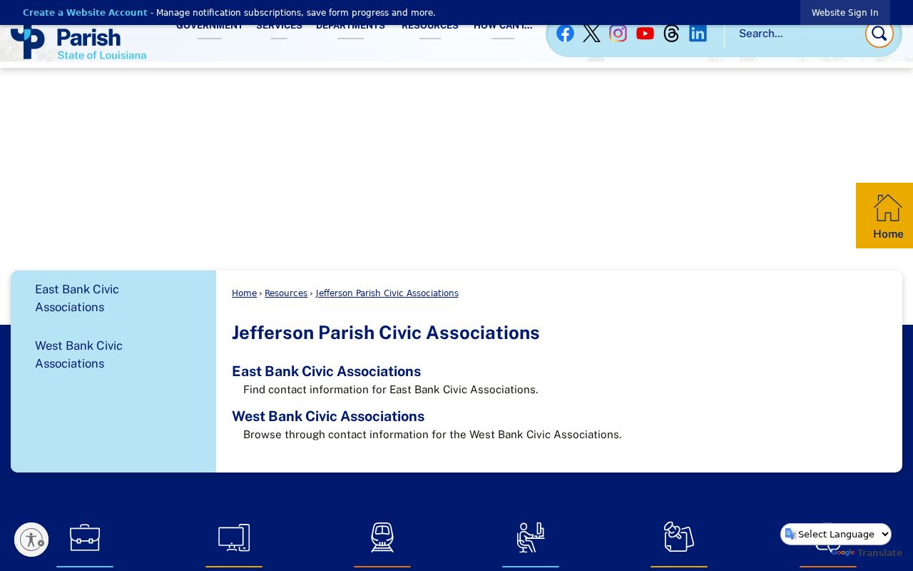
The captured directory separates East and West Bank community routes, which helps select the right local contact before asking about newsletters, meeting minutes, subdivision history, or public events.
East Bank associations
Examples include Airline Park, Beachview Heights, Beverly Knoll, Bissonet, Bonnabel, Bucktown, Bunche Village, Causeway, and Central Kenner.
West Bank associations
Examples include Avondale Homes, Barataria Estates, Baywood, Bellemeade, Bent Tree, Bridge City, Crown Point, Greater Harvey, and Gretna Community.
Ask an association for public newsletters, events, maps, or historical material. Do not request a private member roster. The parish directory is a routing tool, not a government-certified boundary map.
Read Jefferson Block Activity
Permits and code cases show what happened at a site. The parish MGO Connect portal covers building and trade filings, planning and zoning applications, and listed local licenses in parish jurisdiction. The service-request search accepts address, service ID, and complaint number. Public results may identify an applicant or owner, work type, inspection, violation, and date.
These facts can explain construction noise, demolition, a new use, or a lot change. They cannot identify every resident or prove that the applicant occupied the property. Incorporated-city addresses need the city’s permit or code custodian. When the portal returns nothing, ask for an existing file by exact address, record type, and date range under Louisiana Public Records Law.
Community newsletters, old directories, Sanborn maps, newspapers, and parish library collections add history when a block has changed names or numbers. Keep historical occupants separate from current Jefferson Parish neighbors.
Official Jefferson Records or Data Brokers
Commercial neighbor tools often blend old addresses, phone data, relatives, and other purchased material without showing the record date or custodian. Official rolls are narrower, but they reveal who made the record and what field is actually being reported. That makes them easier to check.
| Source type | Strength | Important limit |
|---|---|---|
| Assessor and GIS | Dated parcel, assessed owner, legal and map context | No complete occupant list; GIS is not a survey |
| Clerk index and image | Recorded instrument and parties | Party-led search; access differs by year |
| Voter and permit records | Specific dated civic or site clue | Protected fields and jurisdiction limits |
| Commercial category | May combine many leads | Age, source, accuracy, and lawful-use limits may be unclear |
Start with the custodian and preserve the date. If sources conflict, check the parcel detail, instrument image, municipal boundary, and current office record rather than choosing the most convenient result.
Privacy for Jefferson Parish Neighbors
Public records do not reveal every person on a block. Renters, children, relatives, guests, and apartment occupants may not be indexed by the Assessor. Utility, delivery, school, medical, and private association records do not become public simply because they relate to an address. Protected voter addresses must remain protected.
Use block records for civic curiosity, genealogy, reconnecting, property research, or personal safety awareness. Keep the inquiry narrow and verify a public result with the office that created it. Do not approach a person based only on an old mailing address or blended data profile.
Lawful use. Jefferson Parish neighbor records must never be used to stalk, harass, threaten, intimidate, or expose a protected person.
Your neighbors are people, not entries to collect. A careful block lookup distinguishes parcels from households, owners from occupants, and public contacts from private membership. That produces useful local context without pretending an official neighborhood roster exists.